Wednesday 30 March 2011

Alun-alun Yogyakarta

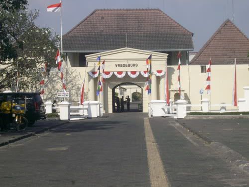
Alun-alun (note: correct orthography hyphenated but occurs occasionally without, also found as aloen-aloen, aloon aloon, and erroneously alon-alon) is a Javanese architectural term for the large central open lawn squares common to villages, towns and cities in Indonesia.
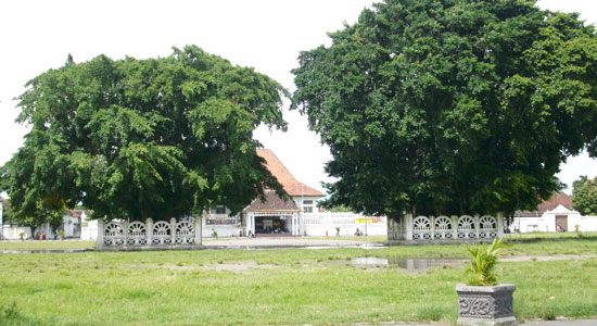
Commonly, alun-alun in modern-day Indonesia refers only to the two large open squares of kraton palace compounds.
Each kraton has two alun-alun: the most important and northern alun-alun lor and the less important and commonly smaller southern alun-alun kidul. The court of Pakubuwana in Surakarta is unique as it incorporates the alun-alun kidul within the defensive wall of the kraton proper.
The alun-alun lor also historically functioned for a place for public corporal punishments and executions. Condemned criminals were publicly executed by krissing (using a keris to stab the condemned from the left shoulder blade downward into the heart) beside the enclosed banyan trees of the alun-alun lor. For especially heinous criminals, most especially traitors and vicious brigands the condemned's head would be impaled on a pike as a macabre public warning
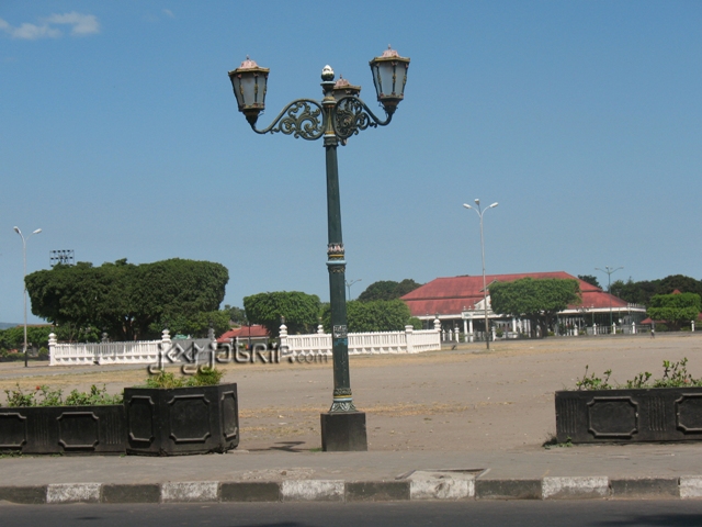
The alun-alun lor functioned and continues to function as centre for public spectacles, court celebrations and general non-court entertainment. The Javanese festivals of Garebeganan and Sekaten great fairs were held here, as they are still held today, with the spectacle of huge mountains of rice exiting the kraton for blessings at the mosque and distributed to the people in the alun-alun lor. Occasionally a social and entertainment spectacle of a tiger and buffalo fight wold be held, though from Sultan Hamengkubawana VII onward these were rare, as the Yogyakarta court tigers were incredibly useful for public sanitation as they were fed a diet of stray dogs.
The alun-alun lor was the only place where the Sultan would conduct dialogue with his people, and functioned to show his humanity and humility.
The alun-lun kidul was more of a generic ground, principally for everyday mustering troops or servants and for exiting officials, servants and workers attending to mundane everyday business.

sumber: http://en.wikipedia.org/wiki/Alun-alun

Thursday 24 March 2011

Tugu Jogja

Tugu Jogja is the most popular landmark of Yogyakarta. This monument is located right in the center of the crossroad between the Mangkubumi, Soedirman, A.M. Sangaji and Diponegoro roads. The Tugu Jogja that is almost 3 centuries old has a very deep meaning and it keeps some history records of Yogyakarta.
Tugu Jogja was built around one year after the construction of Yogyakarta Kingdom. At the early time of its construction, it clearly described the philosophy of the unity of God's creatures that means the spirit of togetherness of lay people and authorities to fight colonials. In Javanese term, the spirit of togetherness is called golong gilig that is clearly described in the construction of the monument: the pole is of gilig (cylinder) form and the top part is golong (rounded). This monument was known as Tugu Golong-Gilig.
In details, the monument was originally constructed in the form of a cylindrical pole with conical form upwards. The base is an encircling fence while the top is rounded. The preliminary height of the monument was 25 meters.
Everything changed when on Monday, 10 June 1867, a big earthquake in Yogyakarta ruined the monument. The collapse of the monument was the transition time when the unity was not really reflected on the monument.
The situation changed totally when in 1889 the Dutch government renovated the monument. The monument was constructed as a square with each side being decorated with a kind of inscription containing the names of people who were involved in the renovation. The top portion is no longer rounded but a pointed cone. The height of the monument is also lower, namely 15 meters. Since then, this monument was also called as De Witt Paal or Tugu Pal Putih (white pole monument).
The renovation of the monument was actually the tactic used by the Dutch colonial to erase the philosophy of togetherness between lay people and the king. Learning from the result of the struggle afterwards, however, the effort did not seem to be successful.

sumber: http://www.yogyes.com/en/yogyakarta-tourism-object/museum-and-monument/tugu-jogja/

Sendang Sono - The Lourdes of Indonesia

You will reach Sendang Sono after passing through bending street at the foot of Menoreh hill. There are two alternatives in order to reach the place from Yogyakarta, namely via Jalan Godean to arrive at Sentolo before turning right, or via Jalan Magelang to come to T-junction of the market in Muntilan city before turning left. The distance is around 45 kilometers from Yogyarta, or it will take you one hour to get to the place by motorcycle.
An entrance with stone wall on both sides will lead you to the vast pilgrimage complex where you will find small chapels, the path of Jesus Sacrification, the Cave of Maria, shelters, and kiosks selling praying goods. Cool weather will greet you upon entering the complex thanks to many growing trees there.
Sendang Sono was named by its location. Sendang means water spring and Sono means the sono or sonokeling tree, denoting that the spring is located under the sono tree. If you will see the spring and the sono tree, please turn right upon entering the gate. Unfortunately, you will not be able to see the spring clearly because it is closed with glass box.
Before 1904, this spring was wellknown as Sendang Semagung, which functioned as the resting place of the bhikku who left for Boro area, the area to the south of Sendang Sono. Since 20 May 1904, however, by the arrival of Father Van Lith and baptism of 173 people of Kalibawang by using the spring water, this place changed its function to the pilgrimage place for Catholic people.

Praying in front of the Cave of Mary that is located close to the sono tree is another way of seeking tranquility. Many people say their prayer by kneeling down and lighting candles in front of this cave. You can even write your hopes or wishes on a piece of paper and then put it into a firing pot in order for God to receive it. For your information, the statue in this complex was directly shipped from Spain.
In addition to pacifying yourself and praying, you can also enjoy the enchantment of the complex architecture designed by Father Y.B Mangunwijaya Pr and it won AGA Khan Awards. You can also sit relax in the shelter while enjoying the surrounding buildings dominated by stone as the material, or stand on the small bridge to enjoy the beauty of the flowing river underneath.
When you are going to leave, do not forget to take some spring water flowing from the taps at the side of the river. The water is believed to give blessings to anyone who drink it or use it for many other purposes. It will complete your contemplation and wishes that you say in your prayer.

sumber:http://www.yogyes.com/en/yogyakarta-tourism-object/religious-sight/sendang-sono/

Pantai Siung

Siung Beach is located in a remote area in Gunung Kidul Regency, to the south of Tepus Sub-Regency to be exact. The distance is around 70 kilometer from the center of Yogyakarta city or it will take you around 2 hours drive. Since it is difficult to get public transportation to go the beach, it would be easier if you make your travel with your own vehicle. Public bus or mini van from Wonosari city will stop at Tepus area only and you have to wait long to get one.
When you plan to make your travel by your car or motorcycle, make sure that they are in a very good condition. The reason is that you are going to go through challenging road with climbs, sharp bending and sometimes slopes under the hot sun in between limestone hills and vegetable fields. You will have to overcome all the hindrances since you come to Pathuk area (the first Sub-Regency that you will pass by in Gunung Kidul Regency) until you get to the beach.
You cannot escape from the hindrances. The easiest route with smooth asphalted road you best take is Yogyakarta - Wonosari continued with Wonosari - Baron - Tepus route. Another route, namely Yogyakarta - Imogiri - Gunung Kidul, has harder challenges with road full of holes, while Wonogiri - Gunung Kidul route is to far to take from Yogyakarta city.
Suffering before getting the happiness seems to represent your journey to Siung Beach. You will fee happy, released and peaceful after you get to the beach. The blue ocean and white, clean sands will cure tiredness. Some wooden houses are available for visitors to take shelter or to have a chat with friends while enjoying the beauty of the beach panorama.
One of the prominent enchantments of Siung Beach is its coral reef. The huge coral reefs at the west and east parts of the beach have important function to add the beauty of the scenery and to border with other beach.
The coral reef of which form resembles the fang of a monkey protrudes little bit to the ocean. The name of the beach was - according to Wastoyo, the local senior leader - taken from the form of the coral reef that resembles the shape of a monkey's fang. The coral reef remains beautiful to enjoy with the waves sometimes hit it and the seawater permeates through its cavities.
The monkey's fang coral reef that still stands firmly despite eroding waves becomes the witness of the triumph of Siung area in the past. Wastoyo tells that Siung area was one of the trading centers during the time of Islamic leaders in Gunung Kidul area. Close to the beach, in Winangun area, there is a traditional market. Here, Mrs Kami and Mrs Podi, the widows of the servants of the Yogyakarta and Surakarta Kingdoms lived.

sumber: http://www.yogyes.com/en/yogyakarta-tourism-object/beach/siung/

Pantai Parangtritis


Located about 35 km to the south of Yogyakarta, Parangtritis Beach has long been famous, not only as a beach resort where sand-dunes, sandy beaches and rocky cliffs meet, but also as a historical place closely linked to the mysterious legend of the Queen of the South Sea, "Kanjeng Ratu Kidul". Together with her confidant, the feared Nyai or Nyi Roro Kidul, the ever youthful and beautiful queen, Kanjeng Ratu Kidul reigns over sea-nymphs and spirits.
The legends say that Kanjeng Ratu Kidul was married to one of the Mataram Monarchs, Panembahan Senopati, whom she visited and communed with on certain occasions.
On certain days known as Suro in the Javanese calender, locals have a ceremonial procession, with many seen presenting offerings on the beach in honour of the Nyai Roro Kidul and Queen of the South Sea. During the day, many visit the beach and hold what is known locally as tirakatan (one-day fasting) as they pray for their wishes to be fulfilled. People in black are frequently seen sitting on the beach in a meditating pose the whole night. Locals who have meditated on the beach have said that through meditating they could see a green dragon and Nyi Roro Kidul, who remains young and beautiful. "The dragon danced before my eyes," one local said in a convincing voice. Another admitted that he meditated there so that he could meet the ever-youthful and beautiful Nyi Roro Kidul. "I can even communicate with spirits here," he added.
The legend of Nyi Roro Kidul herself is very popular. Before turning into a nymph, Nyai Roro Kidul was a young princess named Dewi Kandita, the daughter of King Mundangwangi and his first wife. The popularity of Dewi Kandita and her mother Dewi Rembulan was beyond doubt. They were known for their beauty, kindness and friendliness, and people loved them. However, the misery of their lives began when Dewi Mutiara, another wife of King Mundangwangi, known locally as selir, became green with envy and grew ambitions to become the first wife, thereby deserving full affection and attention from the king.
Dewi Mutiara's dream came true when one day she bore the son that the king had long been yearning for. Through the assistance of a witch, Dewi Mutiara made the king's wives Dewi Rembulan and Dewi Kandita suffer from 'strange' disease, with their bodies covered with scabies that created the odour of fish. The disease led them to be sent into exile in the forest where later Dewi Rembulan died. After a long, hard and helpless journey, the scabies-covered Dewi Kandita eventually arrived at a beach where she met a young, handsome man who promised to cure her illness. At the request of the young man, Dewi Kandita chased after him as he ran along the beach. When she reached the water, the man disappeared and, to her surprise, all the scabies had disappeared but, strangely, she could not move her legs. Half her body, from the waist down, had turned into the body of a fish.
Since then she became a sea-nymph, and the locals believe that Nyi Roro Kidul is the manifestation of Dewi Kandita. Want to see Nyi Roro Ridul? Then try meditating the whole night there as locals have suggested.

sumber: http://www.pbase.com/http://www.indo.com/featured_article/parangtritis.html

Monday 21 March 2011

Keraton Yogyakarta

After Sultan Agung, the Sultanate of Mataram was declining due to power struggle within the sultanate. To make things worse, VOC (Dutch East India Company) exploited the power struggle to increase its control. At the peak of the conflict, the Mataram Sultanate was split in two based on the Treaty of Giyanti of February 13, 1755: Yogyakarta Sultanate and Surakarta Sultanate.
The Giyanti Treaty mentioned Pangeran Mangkubumi as Sultan of Yogyakarta with the title of Sampeyan Dalem Ingkang Sinuwun Kanjeng Sultan Hamengkubuwono Senopati Ingalaga Abdul Rakhman Sayidin Khalifatullah Panatagama (His Majesty, The Sultan-Carrier of the Universe, Chief Warrior, Servant of the Most Gracious, Cleric and Caliph that Safeguards the Religion).
During the era of Dutch occupation there were two principalities, the Yogyakarta Sultanate (Kasultanan Yogyakarta) and the smaller Pakualaman Duchy / Principality (Kadipaten Pakualaman).
The Dutch Colonial Government arranged for the carrying out autonomous self government, arranged under a political contract. When the Indonesian independence was proclaimed, the rulers, the Sultan of Yogyakarta and Prince of Pakualaman made a declaration they would become part of the Republic of Indonesia. Those two regions were unified to form the Yogyakarta Special Region and the sultan became the Governor of Yogyakarta and the Prince of Pakualaman as the vice-governor; both were responsible to the President of Indonesia. The Special Region of Yogyakarta was created after the independence war ended and legalized on August 3, 1950.
In carrying out the local government administration it considers three principles: decentralization, deconcentration and assistance. The provincial government carries out the responsibilities and authorities of the central government, while on other hand carrying out its autonomous responsibilities and authorities. The Regional Government consists of the Head of the Region and the Legislative Assembly of the Region. Such construction guarantees good cooperation between the Head of Region and the Legislative Assembly of Region in order to achieve a sound regional government administration. The Head of the Special Region of Yogyakarta has got responsibility as the Head of the Territory and titled as a Governor.
The first Governor was the late Hamengkubuwono IX, Sultan of Yogyakarta and continued by HRH. Paku Alam VIII as acting governor until Hamengkubuwono X ascended in 1998. Unlike the other heads of regions in Indonesia, the governor of the Special Region of Yogyakarta has the privilege or special status of not being bound to the period of position nor the requirements and way of appointment. However, in carrying out their duties, they have the same authorizations and responsibilities.

sumber: http://en.wikipedia.org/wiki/Yogyakarta_Sultanate

Borobudur Temple


Borobudur, or Barabudur, is a 9th-century Mahayana Buddhist monument near Magelang, Central Java, Indonesia. The monument comprises six square platforms topped by three circular platforms, and is decorated with 2,672 relief panels and 504 Buddha statues. A main dome, located at the center of the top platform, is surrounded by 72 Buddha statues seated inside perforated stupa.
Evidence suggests Borobudur was abandoned following the 14th-century decline of Buddhist and Hindu kingdoms in Java, and the Javanese conversion to Islam.Worldwide knowledge of its existence was sparked in 1814 by Sir Thomas Stamford Raffles, then the British ruler of Java, who was advised of its location by native Indonesians. Borobudur has since been preserved through several restorations. The largest restoration project was undertaken between 1975 and 1982 by the Indonesian government and UNESCO, following which the monument was listed as a UNESCO World Heritage Site.Borobudur is still used for pilgrimage; once a year Buddhists in Indonesia celebrate Vesak at the monument, and Borobudur is Indonesia's single most visited tourist attraction.

Approximately 40 kilometers (25 mi) northwest of Yogyakarta, Borobudur is located in an elevated area between two twin volcanoes, Sundoro-Sumbing and Merbabu-Merapi, and two rivers, the Progo and the Elo. According to local myth, the area known as Kedu Plain is a Javanese 'sacred' place and has been dubbed 'the garden of Java' due to its high agricultural fertility.Besides Borobudur, there are other Buddhist and Hindu temples in the area, including the Prambanan temples compound. During the restoration in the early 20th century, it was discovered that three Buddhist temples in the region, Borobudur, Pawon and Mendut, are lined in one straight line position.It might be accidental, but the temples' alignment is in conjunction with a native folk tale that a long time ago, there was a brick-paved road from Borobudur to Mendut with walls on both sides. The three temples (Borobudur–Pawon–Mendut) have similar architecture and ornamentation derived from the same time period, which suggests that ritual relationship between the three temples, in order to have formed a sacred unity, must have existed, although exact ritual process is yet unknown

sumber: http://en.wikipedia.org/wiki/Borobudur

Tuesday 15 March 2011

'Jalan Malioboro'

Jalan Malioboro is centrally located in downtown Yogyakarta. The street stretches from Tugu Railway Station to the Sultan's Keraton, spanning across some 2 1/2 kilometres in length. Major roads in the city such as Jl Jenderal Sudirman, Jl Mangkubumi, Jl P. Senopati, Jl Sultan Agung, Jl KH A Dahlan and Jl Pasar Kembang will converge at this street. There are a number of large shopping outlets here, apart from the regular and personalised moms-and-pops traditional shops. The expansive Malioboro Mall is located almost midway towards the Sultan's Keraton. A store named Dagadu located on lower ground is the main highlight of the mall, selling funky and contemporary T-shirts that make good souvenirs. There is also a traditional market called Pasar Beringharjo selling all kinds of local goods. Opposite Pasar Beringharjo is a fancy handicraft store called Mirota Batik.
During your stroll, you will also ran across traditional modes of transportation that you may be tempted to try. The most ubiquitous one is the trishaw, a three-wheel pedal-powered bicycle cart, locally known as becak or beca. For the hopeful romantics, there is also an exquisite horse carriage, which is locally known as andong or dokar. Normally, you don't have to look for these carts. The operators will definitely offer you a ride. Some get to the point of chasing you. If you are not interested, do politely decline. If you fancy a ride, a short tour along Jl Malioboro on becak should start from Rp10.000 ($1.20) upwards, depending where you want to go. I was toying with the idea of hiring a becak, but during the haggling discussion, I found out that the becak operator was ready to dupe me (he quoted something like Rp50.000 for a trip to the Sultan's Keraton after knowing I was from Malaysia). Walking away, mortified, he chased me and said, "Rp30.000", and then "Rp20.000". I ended up flagging a reliable and honest taxi driver to my destination for a mere Rp10.000.
In short, do exercise caution when dealing with the street vendors - be it gift sellers or becak operators.

sumber: http://java.uluwatu.org/html/yogyakarta/jl-malioboro.shtml

'Monumen Jogja Kembali'


The sound of serene signaling break time sounded from the Dutch defense post. Under the command of Lieutenant Colonel Suharto, Commander of Brigade 10 of Wehrkreise III area, an attack to the Dutch defense was started after getting an agreement from Sri Sultan Hamengku Buwono IX as initiator of the attack. The Dutch troop that since the Dutch Military Aggression II in December 1948 was distributed to small posts was separated and weakened. During six hours, Indonesian National Army succeeded in occupying Yogyakarta, after hitting the Dutch troop. Right at 12.00 in the afternoon, as it was planned, all Indonesian army drew back from the city center when the Dutch support came; total loose at the Dutch side.
This battle known as Serangan Umum 1 Maret was initial authentication to the international world that Indonesian National Army still had power to fight and to state that the Republic of Indonesia still existed. This was triggered by the capture and the exile of Bung Karno and Bung Hatta to Sumatera setting propaganda that the Republic of Indonesia had not existed.
This news about the six-hour attack was then sent to Wonosari, continued to Bukit Tinggi, then Burma, New Delhi (India), and finally in the main office of the UN in New York. With this news, the United Nations that considered Indonesia to have been independent compelled the execution of KTN (Komisi Tiga Negara / Commission of Three Nations). The meeting held in Des Indes Hotel Jakarta on 14 April 1949, where Indonesia was represented by Moh. Roem and representatives of Netherlands led by Van Royen, resulted in an agreement signed on 7 May 1949. This agreement was later called Roem Royen Statement. In this agreement Netherlands was compelled to withdraw its troop from Indonesia, and to return President and the Vice President, Soekarno-Hatta to Jogja. Finally on 27 December 1949 Netherlands officially handed over the sovereignty of the Republic of Indonesia.

sumber: www.yogyes.com

Monday 14 March 2011

'Taman Sari'


Taman Sari also known as Taman Sari Water Castle is a site of a former royal garden of the Sultanate of Yogyakarta. It is located about 2 km south within the grounds of the Kraton, Yogyakarta, Indonesia. Built in mid 18th century, the Taman Sari had multiple functions, such as a resting area, a workshop, a meditation area, a defense area, and a hiding place.
Taman Sari consisted of four distinct areas: a large artificial lake with islands and pavilions located in the west, a bathing complex in the centre, a complex of pavilions and pools in the south, and a smaller lake in the east. Today only the central bathing complex is well preserved, while the other areas have been largely occupied by the Kampung Taman settlement.

Taman Sari can be divided into four areas. The first area is the artificial lake Segaran located in the west. The second area is a bathing complex in the south of the Segaran lake, called the Umbul Binangun bathing complex. The third area, now completely gone, is the Pasarean Ledok Sari and Garjitawati Pool, located in the south of the bathing complex. The fourth area is the east side of the first and second area, which extend far to the east and to the southeast complex of Magangan.


sumber : http://en.wikipedia.org/wiki/Taman_Sari_%28Yogyakarta%29

'Gunung Merapi'


Mount Merapi, Gunung Merapi (literally Fire Mountain in Indonesian/Javanese), is an active stratovolcano located on the border between Central Java and Yogyakarta, Indonesia. It is the most active volcano in Indonesia and has erupted regularly since 1548. It is located approximately 28 kilometres (17 mi) north of Yogyakarta city, and thousands of people live on the flanks of the volcano, with villages as high as 1,700 metres (5,600 ft) above sea level.
The name Merapi could be loosely translated as 'Mountain of Fire'. The etymology of the name came from Meru-Api; from the Javanese combined words; Meru means "mountain" refer to mythical mountain of Gods in Hinduism, and api means "fire". Smoke can be seen emerging from the mountaintop at least 300 days a year, and several eruptions have caused fatalities. Hot gas from a large explosion killed 27 people on 22 November in 1994, mostly in the town of Muntilan, west of the volcano. Another large eruption occurred in 2006, shortly before the Yogyakarta earthquake. In light of the hazards that Merapi poses to populated areas, it has been designated as one of the Decade Volcanoes.
On 25 October 2010 the Indonesian government raised the alert for Mount Merapi to its highest level and warned villagers in threatened areas to move to safer ground. People living within a 20 km (12.5 mile) zone were told to evacuate. Officials said about 500 volcanic earthquakes had been recorded on the mountain over the weekend of 23–24 October, and that the magma had risen to about 1 kilometre (3,300 ft) below the surface due to the seismic activity.On the afternoon of 25 October 2010 Mount Merapi erupted lava from its southern and southeastern slopes.
The mountain was still erupting on 30 November 2010 however due to lowered eruptive activity on 3 December 2010 the official alert status was reduced to level 3.

sumber: http://en.wikipedia.org/wiki/Gunung_Merapi


'Monumen Serangan Umum 1 Maret 1949'

Monumen 1 Maret Yogyakarta

General attack March 1, 1949 is the attack that took place on March 1, 1949 against the city of Yogyakarta is a large scale planned and prepared by the highest ranks of the military in the Division III / GM III by including several top leaders of local civil government based on the instructions of the Commander in Chief Sudirman, to prove to the international world that the military - also means the Republic of Indonesia - are still there and quite strong, and thus to strengthen Indonesia's position in ongoing negotiations on the UN Security Council with the primary objective to break the Dutch troop morale and prove to the international world that the Indonesian military (TNI) still has the power to organize resistance.
Soeharto at that time as a brigade commander X / Wehrkreis III participate as field operators in the region of Yogyakarta.

sumber: http://www.flickr.com/photos/tjetjep/5054164930/

'Benteng Vredeburg'

Benteng Vredeburg Yogyakarta
Benteng Vredeburg is opposite Gedung Agung. It was built in the year 1765 by the Dutch during the colonial domination against the cannon shot from the Sultan's palace. Its function was to protect the residence of the Dutch Residence. This fort is also surrounded by a moat which still can be seen at present. The fort is rectangular in shape with bastions on the four corners and ramparts which enable the Dutch soldiers to walk around and shoot from. From the base of the cannon on the southern rampart, one has a good view of the Sultan's Palace and other historical buildings and busy traffic around these places. The fort is within walking distance from the centre of town.

sumber: http://www.jogjatourism.com/html/vredeburg.htm